
Map & routes
All stamp stations at a glance – with hiking routes on forest paths and trails, elevation profiles and hand-over to Google Maps.
Chemnitz · Ore Mountains · Glück auf!
88 summits, towers, castles, dams and city landmarks are waiting for your stamp. Hike there, check in via GPS, earn your pins – the hiking badge for our region, no paper required.
Now on Google Play · free download
How it works
From the Totenstein on your doorstep to the Fichtelberg: choose a stamp station on the map – the app shows you the distance, the elevation and what awaits you at the top.
Once you arrive, tap “Stamp now”. Your GPS confirms you are really there. The digital stamp lands in your Steigerpass – tamper-proof.
From 5 stamps you earn the Kupfernadel (copper pin), then tin, silver and gold – all the way to the Steigerkrone (miner's crown). And your health insurer can accept your hikes as proof of activity for its bonus programme.
Everything in one app
Map, stamp book, pins, hiking trails and a feed – Steigerpass puts the whole region in your pocket. Here is what the app can do today:
All stamp stations at a glance – with hiking routes on forest paths and trails, elevation profiles and hand-over to Google Maps.
Check in on site – every stamp passes through a server-side verification chain and is tamper-proof.
Show marked long-distance and hiking trails in colour and see at once which trail leads to which stamp.
Real collector's medals from the Kupfernadel (copper pin) to the Steigerkrone – complete with a little reveal ceremony when you tap them.
No signal on the summit? Stamping still works – the app syncs as soon as you are back in coverage.
Follow friends, send greetings, become a summit patron and compete in weekly, monthly and all-time leaderboards.
Suggest new stamp stations and photos – the team reviews every submission before it goes live.
Light or dark design – to match the daylight and your taste. News & changelog are available right inside the app.
The region
Basalt table mountains, lookout towers, 800 years of mining World Heritage and the forests at the gates of Chemnitz – curated by people who hike here.
Enormous collapse crater from historic tin mining on the edge of Altenberg, around 440 m across and up to 150 m deep, a UNESCO World Heritage site since 2019. A circular mining heritage trail runs around the rim with viewpoints into the crater.
Second-highest peak of the Saxon western Ore Mountains, with a stone observation tower from 1860 and a mountain inn. Sweeping views over the forests around Eibenstock and Johanngeorgenstadt.
1043 m peak near Horní Blatná with a 21 m stone-and-timber observation tower from 1913 and a panoramic view along the ridge of the Ore Mountains. Nearby lie the spectacular mining pits Vlčí jámy and Ledová jáma of the UNESCO World Heritage Mining Region.
Third-highest peak of the Ore Mountains and the highest nepheline basalt dome in Central Europe, around 2 km southwest of Boží Dar. The summit itself is closed off as a nature reserve; a viewpoint lies at the western foot near the ruins of the Spitzberg houses.
Forested peak in the western Ore Mountains west of Wildenthal and north-northeast of Carlsfeld, one of the highest mountains in the Saxon Ore Mountains. Separated from the neighboring Auersberg by the valley of the Große Bockau; a popular hiking and winter sports area.
Saxony's largest and best-preserved castle ruin, perched on a 680 m granite porphyry crag on the eastern ridge of the Ore Mountains. Built around 1200 as a border stronghold on the Silberstraße (Silver Road), with a residential tower, castle chapel and meter-thick curtain wall; open to visitors, with a viewing platform.
Badges
The Ore Mountains were built on copper, tin and silver – and so are your pins. Every tier is a real collector's piece in your digital logbook.
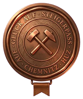
5 stamps
5 stamp stations – you're off to a good start.
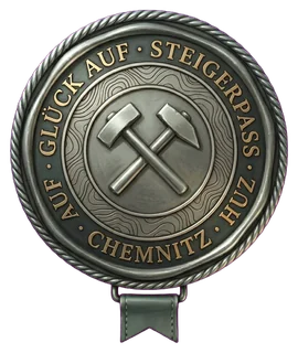
12 stamps
12 stamp stations – you know your way around the region.
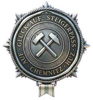
20 stamps
20 stamp stations – silver shine like in old Annaberg.

28 stamps
28 stamp stations – almost every destination bears your stamp.

The big goal
Every stamp station in the region stamped – and you wear the crown as king or queen of the mining district.
For health insurers & employers
Every stamp passes through a server-side verification chain: GPS plausibility, device attestation, speed checks against teleport tricks, daily limits and a trust score per account. What remains is a proof of activity you can rely on.
The app
Map, stamp book, badges, feed, hiking trails and leaderboards – all in one app. For Android and iOS, built with Flutter.
Steigerpass is here · now on Google Play
Steigerpass has officially launched: the app is now available on Google Play (Germany & Austria) – free, ad-free and in three languages (Deutsch, English, Čeština). Grab it, open your stamp book and collect your first stamp. Glück auf!
Get it on Google PlayFreshly shipped: new in version 1.4.1 → see all app updates